
Biography
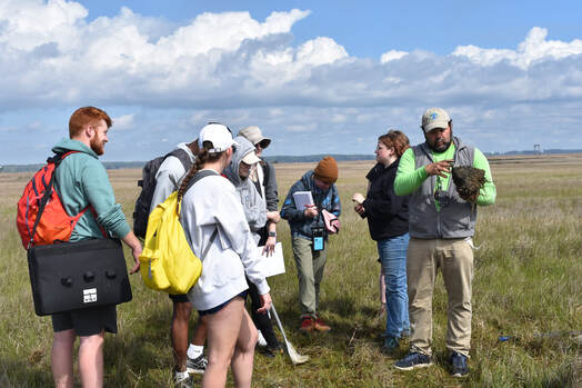
Dr. Cornell is a geologist by training and teaches courses at Shippensburg University in geology, oceanography, and field studies. His background provides a wealth of experience that he uses to teach and mentor student research using diverse living and geological laboratories in the Chincoteague Bay region. Dr. Cornell mentors undergraduate and graduate student projects including M.S. theses in environmental geoscience, geophysics, coastal process monitoring, and sea level change. He has also worked with Dr. Adrienne Oakley (Kutztown University) and others to investigate topics ranging from the geologic history of the Assateague and Wallops barrier islands and Chincoteague Bay to monitoring anthropogenic impacts on impaired salt marshes and maritime forests.
|
Courses Taught
*Summer Course at Chincoteague Bay Field Station |
Education
|
Publications and Honors
Oakley, A.J., Cornell, S.R., Bochicchio, C., Carney, J., and Sabetta, M., (2015). Using Groundwater Data
Sondes to Produce High-Quality In Situ Tide and Wave Hydrographs along Wallops Island, Virginia. Journal of Coastal Research. doi: http://dx.doi.org/10.2112/JCOASTRES-D-14-00101.1
Cornell, S. R., & Oakley, A., 2012, Surface and Sub-Surface Mapping in the Coastal Zone of Wallops Island
NASA Flight Facility, Monitoring Storm Response and Sea-Level Rise: Year 1 Report- March 2011- December 2012, Report of Field Activities, Submitted to NASA Wallops Flight Facility Environmental Group Research Mentor, Mr. Joshua Bundick, Wallops Island, Virginia.
Peck, P.M., and Cornell, S.R., 2016, Analysis of Engineered Oyster Reefs Using 3D Structure From Motion
Photogrammetry: Preliminary Approach, Methods, and Techniques for Quantifying Reef Growth, Geological Society of America Abstracts with Programs. Vol. 48. No. 2.
Cooper, A.T., Oakley, A.J., Cornell, S.R., and Bochicchio, C.J., 2016, Investigating the Development of a Bay Promontory Salt Marsh in Greenbackville, VA through Vibracoring. Geological Society of America Abstracts with Programs. Vol. 47. No. 3. p. 118.
Cornell, S.R., Oakley, A.J., Venn, C., Whisner, J.K., 2015, Monitoring Impacts of Sea-Level Rise and Anthropogenic Impacts on a Mid-Atlantic Mainland Salt Marsh in Greenbackville, Chincoteague Bay, Virginia. Geological Society of America Abstracts with Programs. Vol. 47. No. 3. p. 126.